Pilotbyte RTK Network
Global RTK Corrections to Unlock Centimeter-Level Positioning
Connect to a powerful, reliable RTK correction network built for surveyors, UAV operators, GIS professionals, and autonomous systems. Stream real-time GNSS corrections wherever you work — with global coverage, fast fixes, and device-agnostic compatibility that scales with your team.
Worldwide Coverage. Centimeter Accuracy. Ready in Minutes.
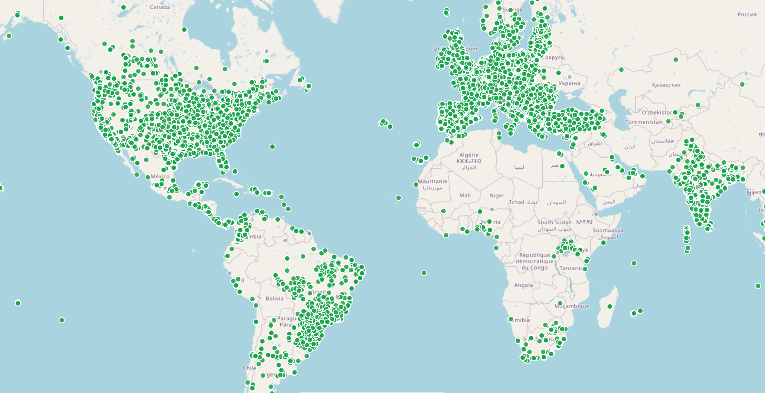
Our RTK Network taps into a distributed network of reference stations to deliver real-time kinematic corrections with survey-grade precision. By minimizing baseline distances and leveraging dense station coverage, you get faster initialization and robust centimeter-level accuracy across regional, national, and global operations.
How It Works
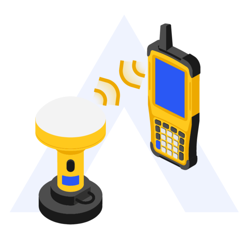
Real-Time GNSS Corrections Over NTRIP
Connect your devices to our network via RTCM streams and start receiving corrections instantly.
Global Reference Station Network
Utilize an extensive constellation of base stations to reduce positional error and improve fix reliability.
Device-Agnostic Integration
Works with any RTK-capable GNSS rover, drone, or survey receiver that supports RTCM/NTRIP protocols.
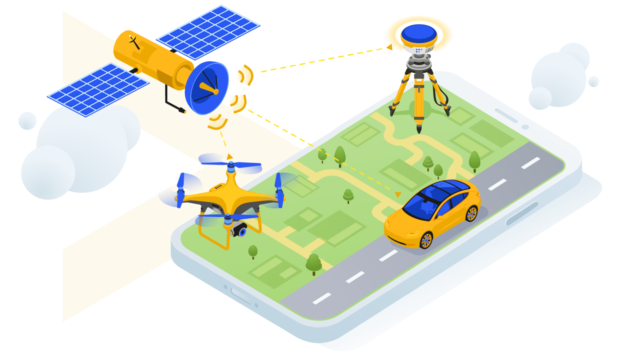
Whether you’re flying UAVs for precision mapping, conducting topographic surveys, or enabling autonomous vehicle navigation, our network delivers the correction data you need with low latency and industry-standard protocols.
Designed for Professionals
From the field to the finish line, our RTK Network supports workflows where precision and speed matter most:
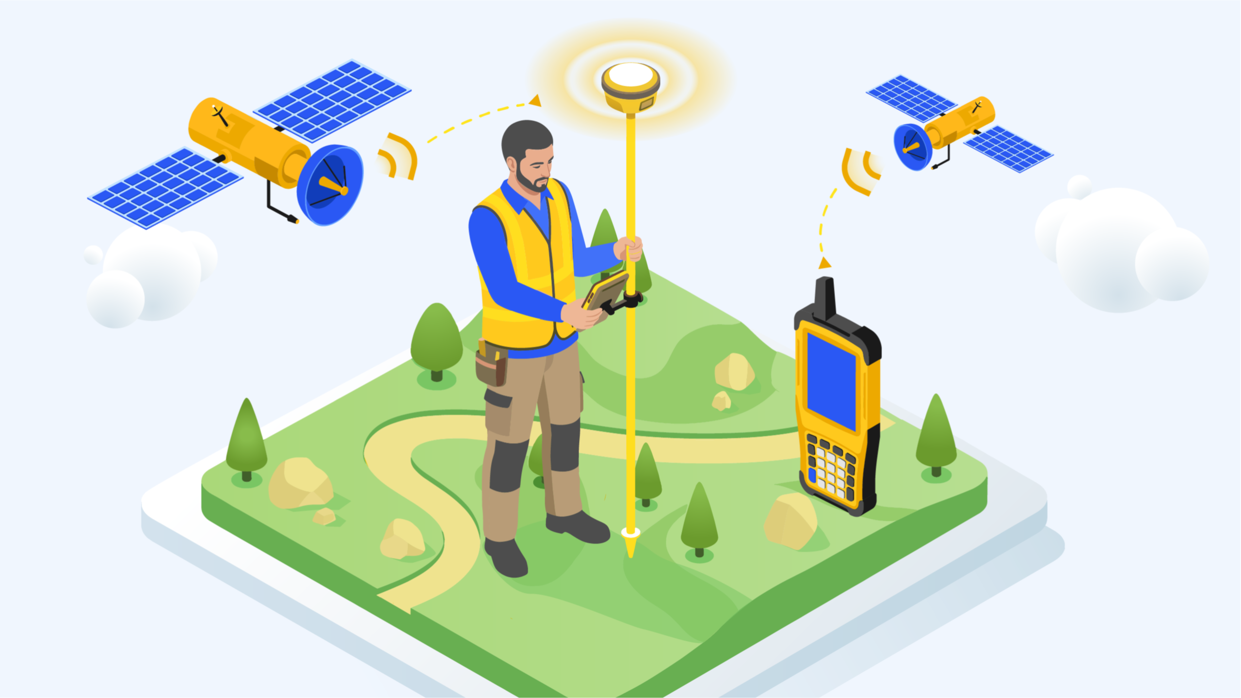
Surveying & Stakeout
Skip deploying a local base station, achieve fast fixes and survey-grade results without sacrificing accuracy.
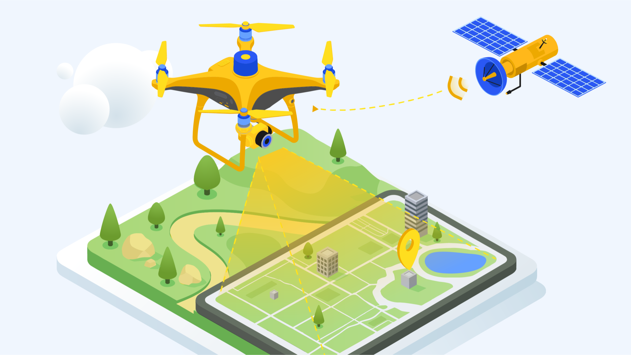
Aerial Mapping
Stream corrections directly to your RTK-enabled drones and produce consistent, centimeter-accurate geotags in real time.
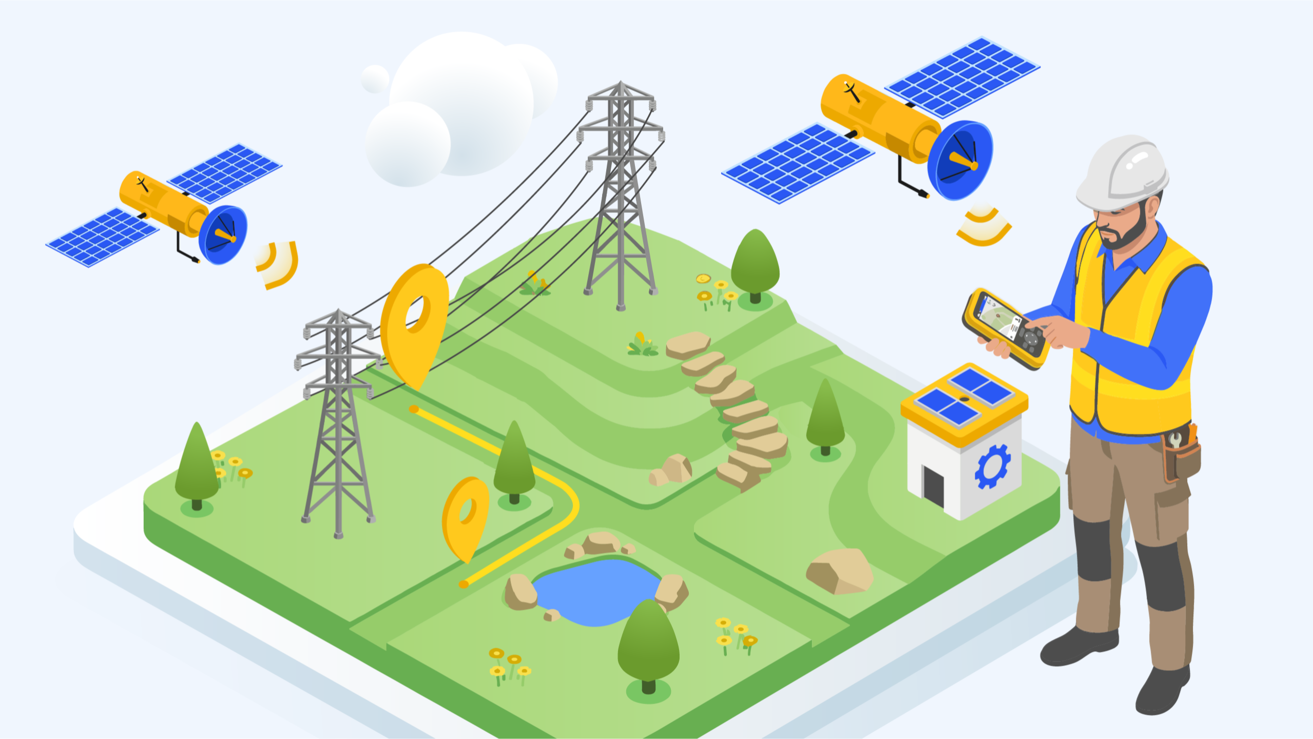
GIS & Asset Management
Receive high-precision GNSS data for handheld and mobile receivers to drive accurate GIS inputs and field verification.
Technical Highlights
Protocols
- RTCM 3.x corrections
- Secure NTRIP Caster Access
- RTK corrections via NTRIP
- Low-latency data access
Constellations
- GPS
- GLONASS
- Galileo
- BeiDou
- Multi-band Support
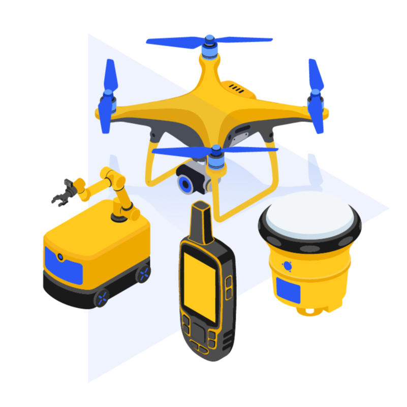
Compatibility
- Drones (DJI / Freefly / Inspired Flight, Wispr Systems)
- GNSS Receivers (Emlid Reach, Trimble, Carlson, Leica)
- NTRIP Enabled Devices
Plans & Pricing
Choose the plan that fits your workflow:
